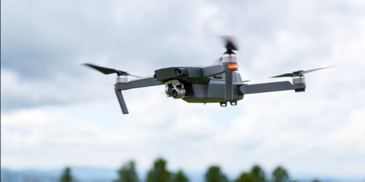
The use of drones for surveying and mapping has become a popular technology in the past few years. Thanks to their mobility, accuracy, and ease of use, drones have been increasingly used by surveyors around the world in order to quickly and accurately obtain data from sites that would otherwise be difficult or dangerous to reach. In addition, they are also able to fly at lower altitudes compared to manned aircrafts making them ideal for tasks such as aerial imagery or topographic surveys.
Drones are capable of collecting highly accurate images and data faster than traditional surveying methods which can save time, money and resources. This is especially useful when surveying large areas with inaccessible terrain, as the drone can cover much more area in a shorter amount of time than a team on foot could manage.
Traditional building survey techniques are those that have been used in the architectural and construction industries for many years. They involve a range of methods, including visual inspection, photography, perspective drawings, laser scanning and ground-based surveying. These techniques are still widely used today due to their ability to capture accurate data in difficult environments or locations that may be hard to access.
When conducting a traditional building survey, it is important to consider all aspects of the site including its design features, structural integrity, safety measures and potential hazards. This data can then be used by architects and engineers to assess any potential risks or improvements which may need to be made before any changes can take place. Traditional building survey techniques provide an invaluable resource when assessing the condition of buildings as well as ensuring they meet legal requirements and standards.
The use of drones for roof inspections is a rapidly growing trend in the construction industry. This new technology offers many benefits to contractors, including increased safety and accuracy. In addition, drones provide an unmatched flexibility when inspecting roofs that traditional methods cannot match.
For starters, drones are capable of reaching areas that might be too dangerous or inaccessible for humans to inspect. On high-rise buildings, for example, drone inspections can significantly reduce the need for costly scaffolding setups and allow workers to remain safely on the ground during the inspection process. Furthermore, with their high manoeuvrability and range capabilities, drones enable inspectors to thoroughly examine details from various angles in minimal time – something that would otherwise be impossible with manual inspections.
Additionally, using drones provides significant cost savings over traditional methods due to reduced labour costs and materials used in setting up equipment or scaffolds.
With more advanced drones on the market, photographers can now capture stunning images from a bird’s eye view. One of the most fascinating aspects of drone photography is that it allows for thermal imaging with special cameras equipped on drones. Thermal imaging captures infrared radiation as temperatures within an object or area and shows these temperature variations in contrasting colours. This technology has a range of applications, such as search and rescue operations and energy efficiency audits.
Thermal imaging resolution on drone cameras varies widely depending on the make and model of the device being used. A high-resolution camera will allow you to capture detailed imagery with higher levels of accuracy while lower-resolution models may provide less clarity but at a much lower price point.
Overall, most experts agree that drone surveys can have both positive and negative implications depending on the situation. On the one hand, they are an invaluable tool for quickly obtaining data in situations where it would otherwise be too difficult or expensive to collect; they also offer higher resolution images than traditional aerial surveys. On the other hand, many professionals point out that drone survey data may not always provide accurate enough results when compared to traditional methods such as LiDAR or photogrammetry.


